How Each Approach Shapes the Way You Drive
Ask a road tripper who started driving before GPS existed and they'll describe something that sounds almost meditative: studying a map the night before a long drive, tracing the route with a finger, memorizing where the route numbers shift and where the terrain opens up. That mental preview doesn't just kill time - it builds a spatial model of the journey that stays with the driver long after the engine turns over.
Digital navigation does something entirely different. It collapses the journey into a single glowing arrow. You follow the instruction, not the landscape. That's genuinely useful - nobody disputes that turn-by-turn guidance has made driving safer and less stressful in urban environments. But it also means many drivers today couldn't estimate which direction they're heading if their screen went dark.
These aren't just philosophical differences. They produce measurably different kinds of drivers - and understanding the gap matters especially when roads get remote, signals drop, or the terrain doesn't match what the app expected. Check out our look at navigation myths that catch drivers off guard for more on what happens when digital confidence outpaces real-world conditions.
Side-by-Side: Paper Map vs. GPS Navigation
The comparison below captures the practical trade-offs that matter most across different road trip scenarios - from cross-country stretches to off-grid detours.
| Paper Map | Digital GPS Navigation | |
|---|---|---|
| Spatial awareness | High - shows full regional context | Low - focuses on immediate turn |
| Real-time updates | None - static at time of print | Continuous traffic and rerouting |
| Cell coverage dependency | Zero - fully offline | High, unless offline maps downloaded |
| Route discovery | Strong - all roads visible | Limited - optimizes for efficiency |
| Ease of use while driving | Requires stopping to consult safely | Hands-free voice guidance available |
| Battery / power required | None | Constant - drains device quickly |
| Learning curve | Moderate - requires practice | Low - intuitive for most users |
| Cost | Low to free (state DOT maps) | Free app, data plan required |
A few of these rows deserve closer attention. Spatial awareness is where paper maps pull furthest ahead: holding a region in your hand - seeing how a mountain range forces the highway to curve, how rivers determine where towns cluster - gives context that no turn-by-turn prompt can replicate. That awareness becomes a safety asset when you're navigating remote stretches with limited connectivity.
On the flip side, real-time updates are GPS's decisive advantage. No paper map can reroute you around a sudden road closure or flag a wildfire evacuation zone. That responsiveness is something no amount of pre-trip map study can match.
What Paper Maps Still Teach That Apps Cannot
There's a particular skill that emerges from regular paper-map use: route intuition. Drivers who've spent time with physical maps tend to understand not just where they're going, but why the road goes that way - how geography, history, and settlement patterns shaped the route. That understanding has practical value. When a GPS reroutes you through an unknown area, a driver with strong map literacy can evaluate whether the new path makes geographic sense. A driver who's only ever followed a blue arrow has fewer tools to make that call.
Practice the Pre-Drive Map Review
Before your next long drive, give yourself ten minutes with a physical map of the region. Trace the route, note the major intersections, and identify where the terrain shifts. You're building a mental backup that activates automatically when technology fails - and it sharpens your sense of the landscape you're about to drive through.
Paper maps also surface discoveries that algorithms don't prioritize. A state highway map shows you every named road, every county seat, every designated scenic byway. GPS apps, by contrast, optimize for time and distance - they'll rarely suggest the two-lane river road that takes twenty minutes longer but passes through three towns with genuine regional character. That's the kind of route context that connects a driver to the history embedded in the highway system.
Even on well-documented routes like Going-to-the-Sun Road in Glacier National Park, a topo map communicates elevation change and hairpin density in a way that a phone screen simply doesn't. Knowing a climb is coming - seeing it represented as tightly packed contour lines - changes how a driver prepares.
Building a Smarter Navigation Kit for the Road
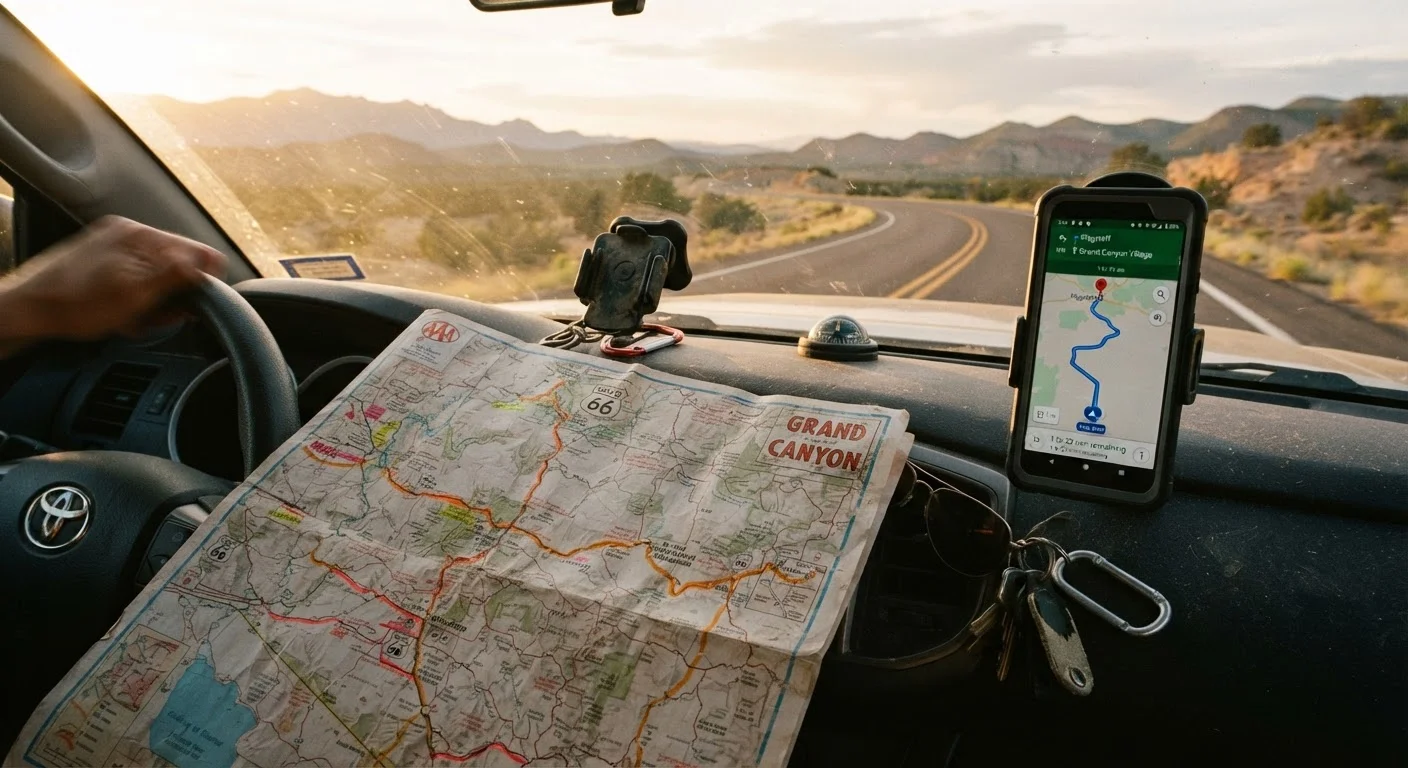
The practical answer for most road trippers isn't a choice between analog and digital - it's a deliberate layering of both. A regional paper map (state DOT maps are widely available and free at many welcome centers) gives you the broad geographic frame. Your GPS app handles day-to-day routing and traffic. A downloaded offline map - available in most major navigation apps - bridges the gap when cell coverage disappears.
Think about your specific route before you leave. If you're tracing coastal corridors versus cutting inland through high desert, the terrain shapes which tool matters most. Our comparison of coastal vs. interior road trip routes gets into how those different spines affect planning decisions across the board.
The habit worth building: before a long drive, spend ten minutes with a paper map. Identify two or three landmarks, note which direction the route generally runs, and understand where the last sizable town sits before your destination. You're not abandoning GPS - you're making sure you'd still know where you were if it failed. That's the kind of redundancy that separates experienced road travelers from those who pull over in a panic when the signal drops.