A Road Built in Eight Months
The Alaska Highway - informally called the ALCAN - didn't start as a traveler's dream. In the weeks following the attack on Pearl Harbor in December 1941, the U.S. military urgently needed a land corridor to supply bases in Alaska and defend against a potential Pacific invasion. The solution: punch a road through nearly 1,400 miles of subarctic wilderness in Canada's Yukon and British Columbia, connecting it to the existing road network at Dawson Creek.
By March 1942, roughly 11,000 U.S. Army soldiers - including segregated Black regiments whose contributions went largely uncredited for decades - began carving the route simultaneously from multiple points. By October of that same year, the road was complete enough for military convoys. The speed was staggering. The conditions were brutal: permafrost, muskeg, mosquitoes, and temperatures that swung from summer heat to early winter freezes.
The highway opened to civilian travel in 1948 and has been maintained and improved ever since. Today, much of it is paved and well-signed, though "improved" is relative - this is still a route that demands more than a casual highway mindset.
“The highway was a remarkable engineering achievement - but what it really represents is the relationship between human ambition and the sheer indifference of the northern wilderness.”
— Ken Coates, Historian and author specializing in Northern Canada and the Alaska Highway
The Route at a Glance
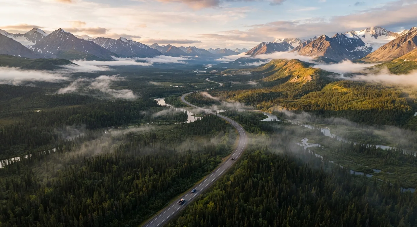
The official highway begins at Mile 0 in Dawson Creek, British Columbia, where a painted post in the center of town marks the start. From there it runs northwest through Fort St. John, Fort Nelson, and Watson Lake before crossing into the Yukon and reaching Whitehorse - the Yukon's capital and the highway's practical midpoint hub. The road then continues northwest through Haines Junction, Destruction Bay, and Beaver Creek before crossing the Alaska border and terminating at Delta Junction, roughly 100 miles southeast of Fairbanks.
Total distance: approximately 1,387 miles (2,232 km). Most travelers allow seven to ten days for the one-way drive, though those who treat it purely as transit have done it in less. The highway complements - or contrasts sharply with - more compact alpine drives like the Going-to-the-Sun Road; scale here is measured in days, not hours.
1,387 mi
Total official highway length
Measured from Dawson Creek, BC, to Delta Junction, Alaska, based on Alaska DOT and Yukon government figures.
8 months
Time to build the original road
The U.S. Army completed the initial pioneer road between March and October 1942 under extreme conditions.
100+ mi
Longest fuel gap on the route
Some stretches between fuel stops in the Yukon remain over 100 miles - always fill up at every opportunity.
What the Road Actually Demands
Don't let the pavement fool you. The Alaska Highway still has frost heaves - sudden undulations in the road caused by permafrost shifting beneath the surface - that can catch an inattentive driver hard. Sections under repair are common, particularly after winter, and gravel stretches appear without much warning.
Rocks kicked up by passing vehicles are a real hazard. A cracked windshield is practically a rite of passage. Protect your headlights and fog lamps with tape or a commercial guard, carry a spare tire (some drivers carry two), and know your vehicle's capability before you go. For a fuller pre-departure checklist, the pre-trip readiness guide covers the essentials worth reviewing before tackling any remote scenic route.
Wildlife on the Road Is a Real Hazard
Bison, moose, and bears regularly cross or stand on the highway, particularly at dawn and dusk. A moose collision at highway speed is potentially fatal. Reduce speed in low-light conditions and stay especially alert in the stretches through the Yukon's bison management zone near the highway's northern sections.
Cell coverage is sparse to nonexistent for long stretches. A satellite communicator - a device that allows two-way messaging and SOS signaling via satellite - is considered standard kit by experienced ALCAN drivers. Download offline maps before you leave. Fuel up every time you have the chance.
Tape your headlights before you leave Dawson Creek. A strip of clear packing tape over the lens face can prevent the small rock chips that, over hundreds of miles of gravel, add up to cracked plastic.
Headlight damage and cracked windshields are among the most common and preventable vehicle issues on the ALCAN. Experienced drivers treat this prep as non-negotiable.
Keep a handwritten log of fuel stops and mileage. Even with offline maps, knowing exactly how far you've come since your last fill-up builds situational awareness that GPS alone won't give you.
Cell and data dead zones are frequent on long stretches of the highway. Physical record-keeping is a reliable backup when technology fails.
Landmark Stops Worth Slowing For
Watson Lake Sign Forest (Watson Lake, YT): Started in 1942 by a homesick U.S. soldier, this ever-growing collection of hometown signs now numbers over 100,000. It's quirky, touchingly human, and quintessentially highway.
Liard River Hot Springs Provincial Park (BC): One of the most welcome stops on the entire route. The natural hot pools here are genuinely beautiful, and the surrounding boardwalk cuts through an unusual warm-water ecosystem that supports plant life far north of its normal range.
Kluane National Park (YT): The highway skirts the edge of this UNESCO World Heritage Site - home to the largest non-polar icefields on Earth. Sheep Mountain offers an accessible viewpoint and is a reliable spot for Dall's sheep sightings on the hillside.
Destruction Bay: The name came from a storm that destroyed a construction camp in 1942. Today it's a small community on the shores of Kluane Lake - one of the Yukon's largest - and a genuinely atmospheric place to pause and watch the lake light change.
If Alaska itself is the destination, the Alaska Inside Passage vs. Open Ocean routes offer a compelling complement to an overland journey once you arrive.
Planning the Drive Honestly
The ALCAN is not a route where you improvise accommodation. In peak summer, campgrounds and lodges fill quickly - particularly around Liard Hot Springs and Kluane. Book ahead for any nights you want secured. Conversely, if you're comfortable dispersed camping on Crown land in Canada, there's extraordinary freedom to pull off and camp in the wilderness.
Budgeting for the unexpected is essential. Fuel costs significantly more in remote communities than at the highway's endpoints. Mechanical repairs, if needed, may require waiting days for parts to arrive. Consider travel insurance that includes roadside and evacuation coverage for remote areas - verify the details of any policy carefully before relying on it.
For those weighing the ALCAN against other major American road trip backbones, the coastal vs. interior drives comparison helps frame what kind of road trip experience you're actually after before committing to a route of this scale.
Carry More Than You Think You'll Need
Extra engine oil, coolant, a basic tool kit, and two to three days of emergency food and water aren't paranoia on the ALCAN - they're standard preparation. The nearest mechanic or grocery store may be many hours away, and weather can change plans quickly.
When to Go - and When Not To
Late May through early September is the practical driving window. Road conditions are at their best, daylight is extraordinary (Whitehorse sees nearly 20 hours of daylight around the summer solstice), and services are open. Mid-June through July is peak season.
Driving the ALCAN in shoulder seasons - April or October - is possible but requires genuine preparation. Snow can close passes, some services shut down entirely after mid-September, and conditions can change rapidly. Winter driving on this route is a specialized undertaking reserved for experienced cold-weather drivers with properly equipped vehicles.
Wildlife is most active at dawn and dusk - which at peak summer means very early morning and very late evening. Stone's sheep, woodland bison (reintroduced to the Yukon along the highway corridor), moose, black bears, and grizzlies are all possible encounters. Slow down when you see animals near the road; never approach or feed wildlife under any circumstances.
Travel conditions, border crossing requirements, and road status can change. Always verify current road conditions with the relevant provincial and territorial transportation authorities and consult official government sources for entry requirements before travel.