What the Wakhan Corridor Actually Is
On most maps, the Wakhan Corridor appears as a thin finger of land - roughly 350 kilometers long and sometimes fewer than 30 kilometers wide - projecting eastward from the Afghan province of Badakhshan until it touches the Xinjiang border of China. This peculiar shape is no accident of nature. The corridor was drawn in 1893 as a buffer strip between the competing imperial spheres of Britain and Russia, ensuring that neither the Indian subcontract nor Central Asia would share a direct frontier. The geographic result is one of the most isolated inhabited valleys on earth.
To the north lies the Tajik Wakhan, a mirror territory across the Panj and Pamir rivers. To the south, the Hindu Kush rises sharply into what was once Pakistani-administered territory. To the east, the corridor climbs into the Pamir plateau - the so-called Roof of the World - before abutting China. This convergence of borders, mountain ranges, and river systems makes the Wakhan a geographical anomaly as compelling as any on the continent.
For trekkers familiar with Central Asia's great routes, the Wakhan occupies a different register entirely from, say, the Pamir Highway's demands. The highway, however remote, follows a road. The Wakhan does not.
The Terrain: Altitude, River Systems, and Seasonal Windows
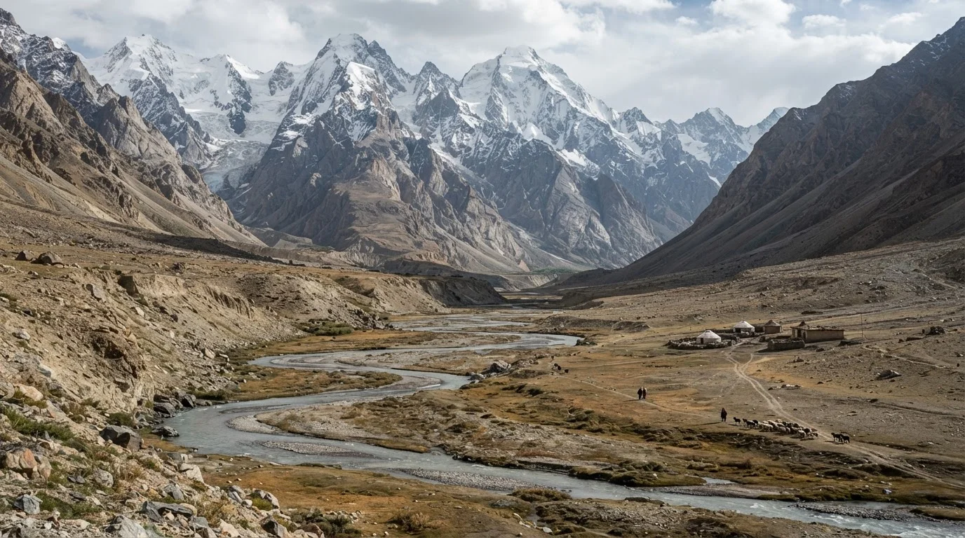
The lower Wakhan Valley, accessible from the town of Ishkashim, sits at roughly 2,800 to 3,200 meters above sea level. The Panj River carves the northern boundary; the Wakhan River threads through the interior. Villages here - Qala Panja, Sarhad-e-Broghil - are the last permanent settlements before the valley narrows and climbs into the Big Pamir and Little Pamir sub-regions, where elevations regularly exceed 4,200 meters.
Vegetation shifts dramatically with altitude. The lower corridor supports irrigated fields, willows, and poplars planted by villages. Beyond Sarhad, the landscape becomes semi-arid steppe and boulder-strewn moraine. The Big Pamir lake system - including Lake Chaqmaqtin - sits above 4,000 meters and remains frozen for much of the year. Pass crossings into Pakistan via Broghil or into Tajikistan via high Pamir routes can exceed 5,000 meters.
~350 km
Length of the Wakhan Corridor
The corridor stretches from Ishkashim in the west to the Chinese border in the east, narrowing to under 30 km at points.
4,200 m+
Typical elevation in the Big Pamir
High Pamir sections of the route regularly exceed 4,200 meters, with key passes approaching or exceeding 5,000 meters.
6-8 weeks
Usable trekking season window
Late June through early September represents the practical window for high-altitude travel; conditions vary significantly year to year.
The usable trekking window is narrow: late June through early September at lower elevations, with even tighter margins at high altitude. Snow can fall at the passes in August. River crossings fed by glacial melt are most dangerous in midday heat during July and August. Historically, experienced trekkers have approached timing conservatively, building extra days for weather delays and acclimatization.
For context on comparable high-altitude wilderness demands, a comparison of premier trekking regions illustrates how infrastructure, altitude, and remoteness interact differently across the globe.
The Wakhi and Kyrgyz Peoples: Who Lives Here
The Wakhan is not empty. Two distinct communities have called this corridor home for centuries, and any traveler who understands this arrives differently.
The Wakhi people inhabit the lower and middle corridor. They speak Wakhi, an Eastern Iranian language unrelated to Dari or Pashto, and have historically practiced a form of Ismaili Islam associated with the Aga Khan's network of development organizations, which has built schools and health posts in the valley. Agriculture and animal herding define the seasonal calendar; yaks, sheep, and goats are driven to high summer pastures while crops of wheat and potatoes are tended below.
Learn at least a few words of Wakhi before arrival - even basic greetings signal respect to a community that receives few outsiders and has no expectation of being understood.
Wakhi is not widely spoken outside the corridor and is distinct from Dari, Tajik, and Kyrgyz. Local guides can teach key phrases, but arriving with some preparation changes the dynamic immediately.
Plan your acclimatization schedule conservatively - build at least two rest days before attempting any pass above 4,500 meters, even if you feel well.
Acute mountain sickness (AMS) can develop rapidly above 3,500 meters, and the corridor has no evacuation infrastructure. Experienced high-altitude trekkers consistently cite under-acclimatization as the most common serious mistake.
If traveling the Tajik side, arrange your GBAO permit well before arrival in Dushanbe - processing times and requirements have historically varied, and being turned back at the checkpoint wastes a journey.
The Gorno-Badakhshan Autonomous Region permit is a legal requirement for the Tajik Wakhan. Officials at checkpoints on the M41 do verify these; the permit is separate from the standard Tajik visa.
Higher still, in the Big and Little Pamir, live a community of Afghan Kyrgyz - a group distinct from the Kyrgyz of Kyrgyzstan, who have remained in these high valleys through considerable historical disruption. Their economy is entirely pastoral, organized around yak and sheep herding between seasonal encampments. Housing is the traditional circular felt tent, the yurt. This community has limited access to external markets, education, and healthcare, and has been the subject of various humanitarian efforts over the decades.
These are not curiosities for travelers to observe. They are communities navigating real pressures, and the manner in which outsiders engage - or are guided to engage - matters considerably. The dynamics explored in traveling without a fixer in Central Asia become especially relevant here, where language gaps are profound and context is everything.
Entry Realities: Permits, Access, and the Security Context
This section requires unambiguous directness: as of the time of writing, Afghanistan is under Taliban governance following the events of August 2021. The vast majority of Western governments maintain Do Not Travel advisories for Afghanistan as a whole, including Badakhshan province and the Wakhan Corridor. Travelers must consult their own government's official travel advisory - such as those published by the U.S. Department of State, the UK Foreign, Commonwealth & Development Office, or equivalent national bodies - before forming any plans.
Check Official Travel Advisories Before Any Planning
Afghanistan carries Do Not Travel advisories from most Western governments as of this writing, including for Badakhshan province and the Wakhan Corridor. Conditions can change without notice. Verify your government's current advisory, consult your embassy, and make no travel arrangements without up-to-date official guidance. This article cannot substitute for current safety and entry information.
Prior to 2021, trekking the Afghan Wakhan required a standard Afghan tourist visa, a Badakhshan provincial permit, and in some zones an additional Wakhan-specific permit. These were obtainable but required lead time and coordination. Whether equivalent frameworks exist or are enforced under current governance is not something this publication can confirm.
The Tajik Wakhan - the territory across the Panj River in Tajikistan's Gorno-Badakhshan Autonomous Region (GBAO) - offers an alternative that has historically been more accessible. A GBAO permit, obtainable alongside a standard Tajik visa, opens travel through the Tajik Wakhan valley, including the road that parallels the Afghan corridor. Communities, landscape, and borderland culture are closely related. For many travelers, this route has functioned as the practical means of experiencing the Wakhan geography without crossing into Afghanistan.
Logistics on the Ground: Getting In, Moving Through, Getting Out
Historically, the gateway to the Afghan Wakhan was the town of Faizabad in Badakhshan, reachable by domestic flight from Kabul or by road. From Faizabad, the route continued overland - often by 4WD jeep on unpaved tracks - through Baharak and Zebak to Ishkashim, the last significant town before the corridor proper. This journey alone could take two to three days depending on road conditions.
Within the corridor, movement was on foot, horseback, or by hired vehicle for the first section of track to Sarhad. Beyond Sarhad, the route was entirely foot and pack animal - yaks or horses hired from local communities at rates negotiated through guides or community leaders. There were no guesthouses in the Western sense; hospitality was offered in family homes or teahouses at the few villages, and camping was required for the high Pamir sections.
Supply logistics deserve particular attention: the corridor had no reliable resupply points beyond Sarhad. Trekkers historically carried all technical food and medical supplies from Faizabad or Ishkashim. Altitude sickness, river crossings, and remote injuries had essentially no evacuation infrastructure. The nearest hospital of any capacity was days away.
The Tajik side follows the M41 highway corridor as far as Ishkashim (Tajikistan), with guesthouses in villages like Langar and Yamchun, before tracks continue eastward toward the Wakhan Pamir. The infrastructure, while minimal by most standards, is meaningfully more developed than the Afghan side historically offered. Upper Mustang's restricted-access model offers a useful parallel for thinking about permit-controlled corridors in high-altitude Asian borderlands.
What Responsible Travel Looks Like Here
If and when conditions allow travel to either side of the Wakhan, the corridor demands a particular posture from visitors. Communities here are not oriented toward tourism. There is no hospitality industry to cushion mismatched expectations, no infrastructure to absorb careless behavior, and no mechanism for communities to opt out of interactions they find intrusive.
Experienced travelers to the Wakhan have consistently noted a few non-negotiable principles. Photography of people, homes, and religious spaces should be approached with explicit consent and genuine patience, not as a transaction. Gifts of cash or sweets to children - however well-intentioned - can distort community dynamics over time; local guides are better placed to advise on appropriate forms of reciprocity. Pack out everything carried in. Firewood is scarce at altitude; carry a stove and fuel rather than burning local resources.
Support Local Guides and Horsemen Directly
Hiring locally - guides, horse handlers, home-stay hosts - keeps economic benefit within the corridor's communities. Negotiate rates through your guide or a community liaison rather than bypassing intermediaries. Rates that seem low by international standards may represent meaningful income in a subsistence economy where cash transactions are infrequent.
Economically, hiring local guides, horsemen, and accommodation hosts channels money directly into communities that have limited access to outside income. This is not a romantic abstraction - it is the material difference between a corridor that sees outsiders as net contributors and one that does not.
The Wakhan is not a destination to approach speculatively or impulsively. It rewards those who arrive having done the work: studying the geography, understanding the political context, learning even basic phrases in Wakhi or Tajik, and approaching with the curiosity of a guest rather than the entitlement of a consumer. That preparation is, in the end, what separates meaningful travel from extraction dressed as adventure.
Entry requirements, safety conditions, and travel advisories for Afghanistan and Tajikistan change. Always consult your government's official travel advisory and verify visa and permit requirements with embassies before making any travel plans. This article is for informational purposes only and does not constitute a recommendation to travel to any destination.