What the Eastern Dzongkhags Actually Are
Most travelers who visit Bhutan see the same choreographed geography: the Tiger's Nest Monastery clinging to its cliff above Paro, the weekend market in Thimphu, perhaps a drive to Punakha. These are genuinely remarkable places. But they represent the western edge of a country that extends far deeper into the Himalayas - and that depth is where eastern Bhutan begins.
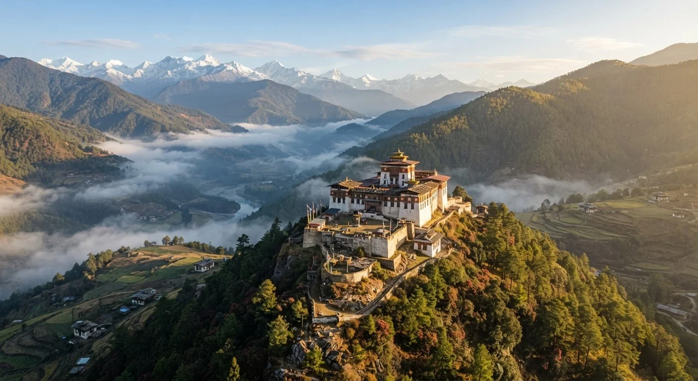
The eastern dzongkhags form a loose arc of districts separated from the rest of the country by the Black Mountains, a range that has historically slowed trade, migration, and now tourism. Trashigang, the largest and most accessible of the eastern districts, sits at an elevation of roughly 1,100 meters above sea level in a deep river valley. Mongar anchors the middle eastern reaches, while Lhuentse, to the north, climbs toward the Tibetan plateau. Each district centers on its dzong - a whitewashed fortress of timber and stone that simultaneously houses monks, civil servants, and centuries of accumulated ritual life.
Language and Local Guides Matter Here
The Sharchop people of eastern Bhutan speak Tshangla, a language distinct from the national Dzongkha, and maintain weaving, farming, and festival traditions shaped by long geographic separation from the capital. Engaging a guide familiar with the east - ideally a native of the region - transforms context into genuine encounter.
The Sharchop people of eastern Bhutan speak Tshangla, a language distinct from the national Dzongkha, and maintain weaving, farming, and festival traditions shaped by long geographic separation from the capital. Engaging a guide familiar with the east - ideally a native of the region - transforms context into genuine encounter.
The Road East: A Journey That Is the Destination
Getting to eastern Bhutan by road is not a concession - it is the experience itself. The lateral highway winds through pine forest, drops into subtropical river gorges, and climbs again past villages where farmhouses are decorated with painted phalluses (a traditional fertility symbol common throughout Bhutan) and prayer flags snap in the altitude wind. Rhododendrons bloom in pink and scarlet along the high passes in spring. Rice terraces catch the October light in the valleys below Mongar.
The journey from Thimphu to Trashigang covers roughly 560 kilometers. Most travelers break it across two or three days, stopping in Bumthang - itself an undervisited district of ancient temples - before continuing east through Mongar. This pacing is not merely logistical. The villages along the route, the roadside chortens (Buddhist shrines), the monks walking between monasteries: these encounters accumulate into a coherent sense of place that a flight cannot replicate.
Fly In, Drive Out - or Vice Versa
Yonphula airport near Trashigang accepts domestic flights from Paro, but schedules are limited and weather-dependent. Consider combining one overland leg with one flight to experience the journey without doubling it. Confirm flight availability well in advance through your licensed operator, as capacity is small and demand from locals can be high during festival periods.
For travelers who fly into Yonphula airport near Trashigang, consider doing so only on the return leg. Arriving overland and departing by air allows you to absorb the full geographic and cultural transition eastward, then exit efficiently without retracing the route.
Sites That Reward the Distance
Trashigang Dzong sits on a promontory above the confluence of the Drangme Chhu river - a setting more dramatic than any postcard has managed to capture. The dzong is still a working administrative center, meaning visitors encounter the texture of actual institutional life rather than a curated heritage site. Gom Kora, roughly 20 kilometers north of Trashigang town, is a small but deeply venerated temple built around an impression said to have been left by Guru Rinpoche. Its annual festival draws eastern Bhutanese from surrounding valleys and offers one of the most unmediated religious gatherings a foreign traveler can attend.
Further north, Lhuentse Dzong rises vertically from a cliff face above the Kuri Chhu river in a way that rivals any fortress architecture in Asia. Access requires a dedicated detour, but the scarcity of visitors here is itself a form of reward. The surrounding villages produce the finest raw silk textiles in Bhutan, a craft tradition tied directly to the district's relative isolation.
~560 km
Road distance from Thimphu to Trashigang
The lateral highway crossing Bhutan east to west covers roughly 560 kilometers, typically requiring two to three travel days.
20
Total dzongkhags in Bhutan
Bhutan is divided into 20 administrative districts; the eastern cluster remains the least visited by international travelers.
1,100 m
Elevation of Trashigang town
Trashigang sits at approximately 1,100 meters above sea level in a river valley - lower and warmer than Bhutan's western highlands.
Travelers seeking a parallel experience in another restricted Himalayan region may find useful contrast in Upper Mustang's walled kingdom of Lo Manthang, where geography and permit systems have similarly preserved a pre-modern way of life. For those drawn to slow, river-paced travel through undervisited landscapes, the Mekong's lesser tributaries in Laos and Cambodia offer a different but thematically adjacent journey.
Practical Orientation for Eastern Bhutan Travel
All international travel to Bhutan operates through licensed tour operators, and the Sustainable Development Fee applies regardless of which region you visit. This fee structure funds public services and is part of Bhutan's deliberate approach to low-volume, high-value tourism. It is not a barrier unique to the east - but the east rewards it more fully, precisely because so few visitors make the journey.
Accommodation in the eastern districts ranges from small government-run guesthouses to modest boutique lodges in Trashigang town. The standard of comfort is honest rather than luxurious; electricity and hot water are generally available, but 24-hour reliability can vary. Travelers who have navigated similarly remote highland districts - Nagaland's highland villages in India come to mind - will find the infrastructure roughly comparable.
Verify current visa requirements, entry conditions, and any protected-area permits directly with the Tourism Council of Bhutan or your licensed operator before making arrangements. Conditions, fees, and seasonal access can change, and official sources are the only reliable reference point.
Travel conditions, visa requirements, and access rules for Bhutan can change. Always consult official government sources and your licensed Bhutanese tour operator for current, accurate information before making travel arrangements.