What the Altiplano Actually Is
The Altiplano - literally "high plain" in Spanish - is one of the most expansive high-altitude plateaus on Earth, second only to the Tibetan Plateau in both area and average elevation. Stretching across western Bolivia and into southern Peru, northern Chile, and northwestern Argentina, the Bolivian portion is the most dramatic and least visited of the four.
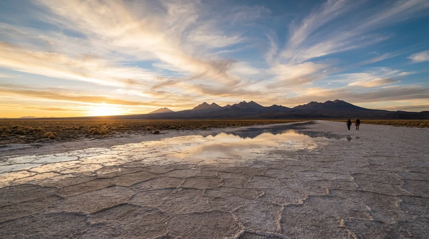
At its heart sits Salar de Uyuni, the world's largest salt flat, covering roughly 10,582 square kilometers. But reducing the Altiplano to this single attraction misrepresents the landscape's scope. Surrounding it are the Eduardo Avaroa Andean Fauna National Reserve with its flamingo-rimmed lagoons, the volcanic corridor straddling the Chilean border, ancient Aymara and Quechua settlement sites, and the surreal Siloli Desert with its wind-carved rock formations. This is not a single postcard - it is an entire geographic world compressed into brutal, beautiful extremity.
The region also holds Lake Titicaca in the north, the highest commercially navigable lake on Earth at 3,812 meters. Together, these landmarks frame a plateau that has supported human civilization for millennia while remaining largely unknown to the mainstream travel circuit. For travelers who have already exhausted the obvious South American routes, this is the continent's most compelling next chapter. South America holds other overlooked arid landscapes worth crossing - but few carry the sheer scale of what Bolivia offers here.
Altitude: The Factor Travelers Most Underestimate
La Paz, the administrative capital and main gateway city, sits at approximately 3,640 meters. Uyuni, the town most travelers use as a base for salt flat excursions, is at roughly 3,670 meters. The Siloli Desert and the colored lagoon circuit push above 4,500 meters, and some volcanic passes near the Chilean border reach 5,000 meters. These are not hiking elevations - they are the elevations at which you eat, sleep, and travel by vehicle.
Altitude Sickness Is a Medical Reality Here
Acute Mountain Sickness (AMS) affects a significant proportion of travelers arriving at Altiplano elevations, regardless of age or fitness level. Symptoms range from headache and nausea to, in serious cases, life-threatening pulmonary or cerebral edema. Do not rely solely on over-the-counter remedies or advice from fellow travelers. Consult a qualified physician before your trip to assess your individual risk and discuss appropriate prevention strategies. If symptoms worsen rather than improve after 24 hours at altitude, descend immediately and seek medical care.
Acute Mountain Sickness (AMS) is a genuine medical concern at these elevations, not a minor inconvenience. Symptoms include headache, nausea, dizziness, and fatigue. In rare but serious cases, it can progress to High Altitude Pulmonary Edema (HAPE) or High Altitude Cerebral Edema (HACE), both of which require immediate descent and medical attention. Consult a physician before your trip to discuss acclimatization strategies and whether preventive medication is appropriate for your specific health situation.
The most common traveler error is flying directly to La Paz from sea-level cities and attempting full itinerary activity within the first 24 hours. Spending two to three days in La Paz before heading higher is one of the most practical things you can do. Drink water, rest, and resist the instinct to push through discomfort with sheer willpower - altitude does not respond to determination.
Plan your first full day in La Paz as a genuine rest day - no sightseeing, no hiking to viewpoints. Your body needs uninterrupted time to begin producing additional red blood cells.
Altitude acclimatization is a physiological process that cannot be rushed; overexertion in the first 24-48 hours is the most common trigger for acute mountain sickness among first-time plateau visitors.
When booking a multi-day salt flat and lagoon circuit, ask specifically whether your vehicle carries supplemental oxygen and whether the guide has wilderness first aid training.
The backcountry circuit reaches elevations where AMS escalation becomes a genuine risk; response time to medical facilities is measured in hours, making on-site preparation the only realistic safety net.
Terrain, Climate, and Seasonal Realities
The Altiplano operates under two dominant seasons that shape what is actually possible on the ground. The dry season runs roughly from May through October. Roads are more reliably passable, skies are clearer, and the Salar's hard crust is at its most navigable. The wet season (November through April) brings rainfall that floods parts of the salt flat with a shallow layer of water, creating the famous mirror effect that turns the horizon into an infinite reflection - spectacular photography, but significantly more challenging logistics.
Temperatures are extreme in both directions. Days at altitude can feel warm under intense equatorial sun, while nights regularly drop below freezing even in summer. Wind on the open plateau is relentless. Visitors who arrive expecting a desert warmth similar to the Atacama are frequently surprised. The Atacama's character differs substantially from the Altiplano - comparing them helps calibrate expectations for both.
Road quality varies dramatically. The main highways connecting Uyuni to Potosí and La Paz are paved and generally accessible year-round. The backcountry circuits through the Eduardo Avaroa reserve are unpaved, remote, and subject to closures during heavy rains. A reliable 4×4 vehicle - and an experienced local guide who knows current conditions - is not optional on those routes.
Wet Season Roads Can Cut Off Access Entirely
Between December and March, heavy rainfall can render backcountry tracks within the Eduardo Avaroa reserve completely impassable, sometimes for days at a time. Even paved routes can be disrupted by flooding near river crossings. If your itinerary depends on specific circuit access during the wet season, build in buffer days and confirm conditions with local operators shortly before departure - not weeks in advance.
Getting There: Logistics on the Ground
Most international travelers arrive via La Paz's El Alto International Airport, one of the highest commercial airports in the world at around 4,061 meters. This means altitude exposure begins the moment you land. Flights connect through Lima, Bogotá, Santiago, and São Paulo among other hubs.
Overland entry from northern Chile - through the Atacama border crossing at Hito Cajón or via the Ollagüe crossing - is used by travelers combining both high-altitude desert landscapes in a single journey. Entry from Peru via Copacabana and Lake Titicaca is popular among those approaching from Cusco and the Sacred Valley.
Within Bolivia, Uyuni is reachable by overnight bus or a short flight from La Paz. The train connection from Oruro to Uyuni, while slower, is a genuinely atmospheric way to approach the plateau. For the southern circuit into the reserve, organized multi-day tours departing from Uyuni are effectively the only practical option - independent vehicle travel in that zone requires considerable off-road experience and logistical self-sufficiency.
See our guide to preparing for high-altitude travel for a fuller breakdown of what the physical demands of this kind of journey actually require before you book.
10,582 km²
Area of Salar de Uyuni salt flat
Salar de Uyuni is the world's largest salt flat, according to geographic surveys of the region.
3,812 m
Elevation of Lake Titicaca
Lake Titicaca is widely cited as the highest commercially navigable lake in the world.
4,061 m
Elevation of El Alto International Airport
La Paz's El Alto airport is among the highest commercial airports globally, meaning altitude exposure begins on arrival.
What to Genuinely Expect from the Experience
The Bolivian Altiplano is not a comfortable destination. That is also precisely what makes it extraordinary. The silence on the salt flat at 5 a.m., with no artificial light for 100 kilometers in any direction, is genuinely disorienting. The geothermal fields near the Chilean border - geysers erupting at dawn against a backdrop of snow-capped volcanoes - are among the most visually alien landscapes accessible by road anywhere on Earth.
The Aymara and Quechua communities that have inhabited the plateau for generations maintain distinct cultural traditions, languages, and market economies. Interacting respectfully - learning a handful of words in Aymara, purchasing directly from artisans at markets in Uyuni and Potosí, understanding that photography of community members is not automatic - matters both ethically and practically. These communities are not a backdrop; they are the living context of the landscape.
“The Altiplano has a way of making you feel both insignificant and extraordinarily present at the same time. There is nowhere to hide from the landscape - or from yourself.”
— Hidden Destinations Editorial Team, Travel journalists specializing in underreported South American destinations
Potosí, perched at over 4,000 meters, is one of the highest cities in the world and a UNESCO World Heritage Site. Its colonial silver-mining history shaped global economics for centuries. Visiting Cerro Rico - the mountain whose mines funded the Spanish Empire - offers a sobering historical layer that few travelers who come only for the salt flats encounter.
If your travel has recently taken you into the Amazon Basin's logistically demanding environment, the Altiplano will feel different in almost every way - drier, colder, starker - but equally serious in its preparation requirements.
Practical Preparation Checklist
- Medical consultation: Discuss altitude illness prevention with a physician before departure; do not self-prescribe medication based on anecdotal advice.
- Layered clothing: Plan for extreme temperature swings - lightweight sun protection during the day, serious insulation for nights and early mornings.
- Hydration: Altitude accelerates dehydration; carry more water than you think you need, particularly on the backcountry circuit.
- Travel insurance: Confirm your policy covers high-altitude trekking and emergency medical evacuation, as standard policies sometimes exclude activities above a defined elevation.
- Cash: ATMs exist in Uyuni and Potosí but are not always reliable; carry sufficient bolivianos for the full circuit.
- Sunscreen and UV protection: At altitude, UV radiation is significantly more intense than at sea level - high-SPF sunscreen, UV-rated sunglasses, and lip protection are not optional.
- Entry documentation: Check current visa requirements for Bolivia relative to your passport. Requirements and fees have changed in recent years and vary by nationality. Always verify with official government sources before travel.
- Permits: Entry to Eduardo Avaroa Andean Fauna National Reserve requires a fee; ensure your guide or operator handles this or that you carry appropriate payment.
Arrive a Day Early in Uyuni Before Your Circuit
Most multi-day tours depart from Uyuni very early in the morning. Arriving the evening before rather than on the same day gives you time to sort gear, confirm logistics with your guide, and get a full night's rest. It also provides a practical acclimatization buffer before heading to the higher elevations of the southern circuit, where altitudes climb well above 4,500 meters.
This article is for general informational and travel planning purposes only. Medical information provided here is not a substitute for professional medical advice. Visa requirements, border regulations, road conditions, and safety situations change; always verify current information with official government sources and relevant authorities before traveling.