Understanding the Great River Road
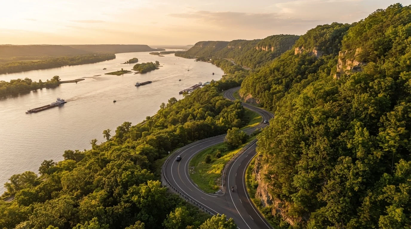
The Great River Road is not a single highway with a single number. It's a designated scenic byway system - a patchwork of state and county roads that collectively trace the Mississippi River from its headwaters at Lake Itasca in northern Minnesota all the way to the Gulf of Mexico near New Orleans, Louisiana. Ten states share the corridor: Minnesota, Wisconsin, Iowa, Illinois, Missouri, Kentucky, Tennessee, Arkansas, Mississippi, and Louisiana.
What unifies these roads is the iconic green pilot's wheel marker, a nationally recognized symbol that keeps drivers oriented across state lines even as the road shifts from a lakeside county highway in Minnesota to a delta levee road in Louisiana. Look for it at intersections - it's your through-line on a route that deliberately trades interstate efficiency for intimate river access.
For context on how this kind of scenic byway stacks up against highway driving, our guide on scenic roads vs. highway efficiency breaks down when the detour is genuinely worth it. Spoiler: the Great River Road almost always qualifies.
What You'll Need Before You Go
Planning this route rewards preparation. Unlike an interstate run, the Great River Road passes through remote stretches where services can be sparse, cell coverage unreliable, and road conditions variable.
What you will need
National Scenic Byways Program website
Provides official segment maps, state-by-state guides, and downloadable resources for the Great River Road.
Offline navigation app (e.g., downloaded maps)
Ensures reliable turn-by-turn guidance in rural stretches where cell coverage is limited.
State tourism office guides
Each of the ten corridor states publishes a dedicated Great River Road travel guide with current highlights and contacts.
Paper state road atlas
Serves as a reliable backup when digital navigation fails in remote river corridors.
Step-by-Step: Planning Your Drive
Follow these steps to build a trip that fits your timeline and interests - whether you're tackling one iconic segment or stitching together a multi-state journey.
Choose your segment and direction of travel
Few people drive all 3,000-plus miles in a single trip. Instead, identify one or two states worth anchoring your journey around - the Upper Mississippi (Minnesota through Iowa) offers bluffs and river culture; the Lower Mississippi (Arkansas through Louisiana) delivers delta landscapes and deep history. Decide whether you'll travel north-to-south or south-to-north based on your starting point and schedule.
Map your overnight stops in advance
River towns along this route range from well-equipped small cities to genuinely rural communities with a single motel. Identify your overnight stops early and book ahead - particularly in summer and fall foliage season, when river corridor lodging fills quickly. State parks with camping are a strong option and often sit directly on the water.
Check current road and flood conditions
The Mississippi River floods. When it does, low-lying sections of the Great River Road - particularly in Missouri, Arkansas, and Mississippi - can close without much notice. Before departing, check each state's Department of Transportation road condition page for your planned dates. Build alternative routing into your plan for any segment within five miles of the riverbank.
Identify two or three anchor experiences per state
Rather than trying to stop everywhere, select a handful of meaningful stops per state: a state park overlook, a historic river town main street, a working ferry crossing or swing bridge. This approach gives each day a loose structure without turning the drive into a checklist sprint. Leave room to follow unmarked gravel roads toward the water - some of the best views on this route aren't on any curated list.
Budget realistic daily mileage
The Great River Road regularly drops to 25-35 mph speed limits through towns, and the route's characteristic curves and river crossings eat into travel time. Plan for 150-200 miles per driving day at most - less if you're genuinely stopping to explore. Underestimating daily time is the most common mistake drivers make on byway routes like this one.
Follow the green pilot's wheel markers
Once you're on the road, the green pilot's wheel signs are your navigational backbone. They appear at turns and key intersections throughout all ten states. If you haven't seen one in a while, double-check your route - the signage can be sparse in transitional stretches between municipalities. Supplement with your downloaded offline map to confirm you're on an official corridor segment.
Combine Segments With a Hub City
Consider anchoring your Great River Road drive around a major hub city - Memphis, St. Louis, or Minneapolis - where you can fly in and fly out. This allows you to drive a focused 3-5 day segment without a multi-day positioning drive each way. It's a practical way to experience the route's best stretches without committing to the full corridor.
Highlights Worth Anchoring Your Route Around
A few standout areas consistently reward drivers willing to slow down. In Minnesota, Winona and Red Wing sit beneath dramatic limestone bluffs that define the Upper Mississippi's character. The Great River Road through Iowa's Pikes Peak State Park delivers sweeping overlooks that rival anything in the region. Natchez, Mississippi - where the Great River Road meets the southern terminus of the Natchez Trace Parkway - combines antebellum history with genuine Mississippi Delta atmosphere.
Down in Louisiana, the route threads past plantation landscapes, cypress swamps, and eventually delivers you to New Orleans, one of America's most culturally layered cities. Each of these anchors is worth at least a full day, ideally more.
Seasonal Flooding Is a Real Planning Factor
The Mississippi River's flood cycles are not rare edge cases - they are a regular feature of life along this corridor. Spring snowmelt and summer storm systems can close river road segments for days or weeks at a time. Always check state DOT road conditions within 48 hours of your departure and have an alternate inland route identified for any low-lying segment on your itinerary.
Making the Most of Each Segment
The Great River Road rewards curiosity over speed. State parks, ferry crossings (yes, working ferries still cross the Mississippi at several points), and small-town diners are as much a part of the experience as any named landmark. Build margin into your daily mileage - 150 to 200 miles per day is a reasonable pace on this route, far less than you'd cover on an interstate.
For a broader framework on structuring overnight stops, daily distances, and contingency planning, The Anatomy of a Well-Planned Road Trip is an excellent companion resource. And if you want a full end-to-end planning system - from route design to vehicle prep - Road Trip Planning From Start to Finish covers every layer. The Mississippi has been drawing travelers to its banks for centuries. A little preparation ensures you actually see it.