A Road Built on a Railroad's Bones
Few American highways carry more history beneath their asphalt than the Overseas Highway. Before cars crossed these islands, trains did. Henry Flagler - the Standard Oil baron who had already linked Miami to the rest of Florida by rail - launched one of the most audacious engineering projects of the early twentieth century: an over-sea railroad connecting the Keys all the way to Key West, which was then Florida's largest city and a major port.
The Florida East Coast Railway's Key West Extension opened in January 1912, threading across 128 miles of open water on a series of causeways and bridges. It was called the Eighth Wonder of the World by the press of the day. The Labor Day Hurricane of 1935 - one of the most powerful Atlantic storms ever recorded at landfall - obliterated long sections of the line and killed hundreds of workers sheltering in the Keys. The railway never reopened. Instead, the surviving bridges and causeways were sold to the state of Florida, and the Overseas Highway was completed using much of that existing infrastructure by 1938.
The Route Has Only One Road
Once you leave the Florida mainland, US-1 is the only road connecting the Keys. There are no alternate routes. Closures due to severe weather or accidents can strand travelers for extended periods. Always check road conditions through the Florida Department of Transportation and monitor National Hurricane Center advisories during Atlantic hurricane season (June through November) before heading out.
That layered origin - Victorian railroad ambition repurposed into midcentury highway - gives this drive an almost archaeological quality. You are never far from the ghost of Flagler's railroad alongside you.
The Seven Mile Bridge: Pavement Over Open Ocean
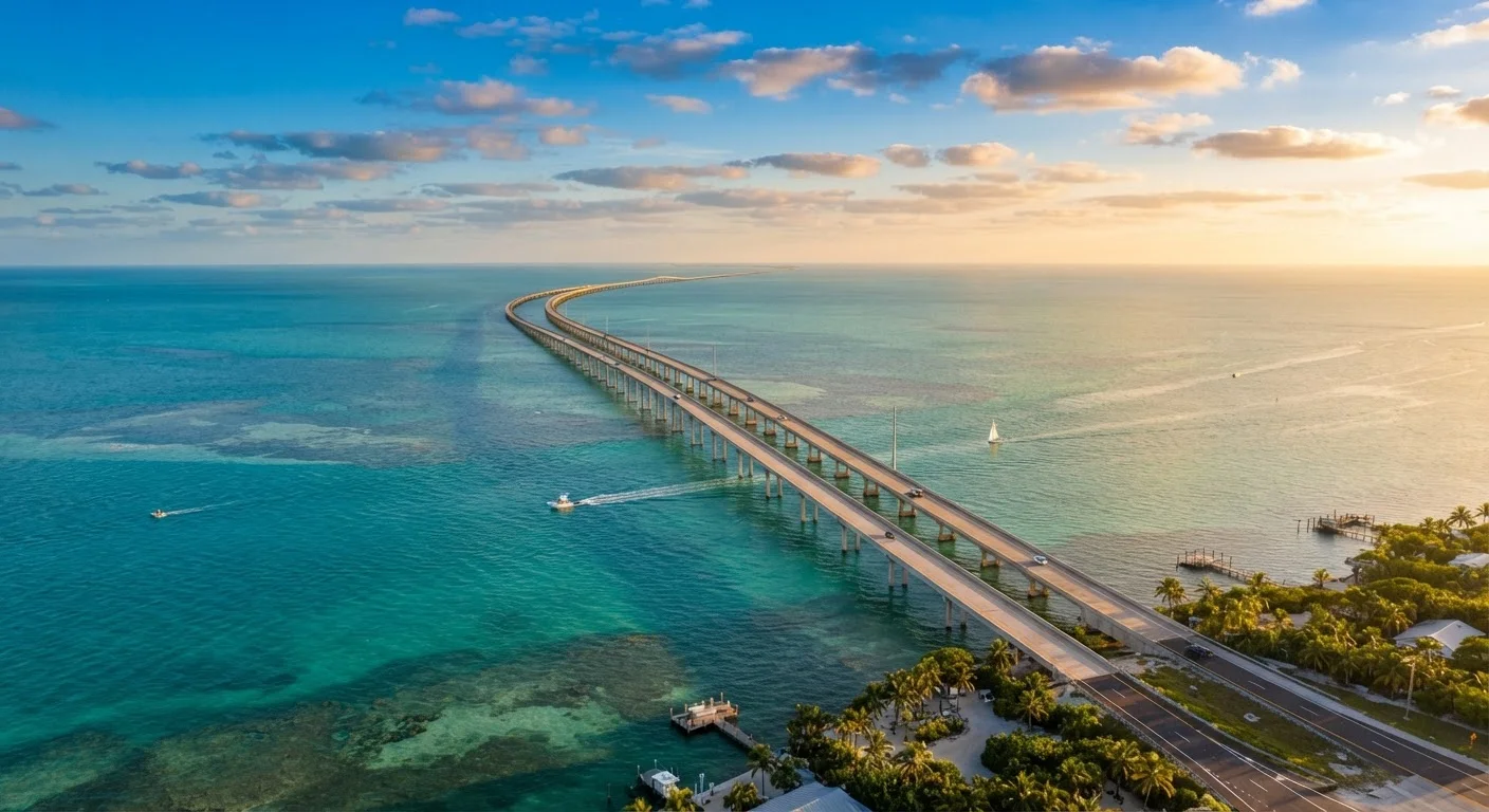
No single stretch defines the Overseas Highway more completely than the Seven Mile Bridge, located near Marathon in the Middle Keys. The current bridge - completed in 1982 and running 35,716 feet - replaced the original Flagler-era structure, which now stands as a historic landmark alongside it. At its midpoint, there is simply nothing around you but water in every direction: the Gulf of Mexico on one side, the Atlantic Ocean on the other, the horizon an unbroken circle.
That sensation of floating above the sea is what makes this stretch singular among American road experiences. Unlike scenic overlooks that require a detour, this panorama is the road itself. The old bridge, visible just to the side, serves as a pedestrian walkway from the Pigeon Key end - a reminder of just how thin the line is between what gets preserved and what gets driven over.
“The Florida Keys highway is the only place in America where you can drive across the open ocean. It's not a metaphor - the road is literally surrounded by sea.”
— Road Trip Culture Editorial Team, Route historians and journey enthusiasts
If you're comparing coastal driving experiences across the country, this stretch is genuinely in its own category. For context on how coastal and interior routes each shape a road trip's character, see our guide to coastal vs. interior drives.
Reading the Keys: From Key Largo to Mile Marker Zero
The Overseas Highway's mile marker system counts down from roughly 126 near Florida City to 0 at the corner of Whitehead and Fleming Streets in Key West. Locals use these markers as a primary address system - asking someone where they live might earn the answer "around MM 52." Learning to read the markers helps orient any traveler along a route that can feel continuous but is actually a mosaic of distinct island communities.
42
Bridges crossed along the Overseas Highway
The Florida Department of Transportation maintains 42 bridges along US-1 through the Keys, ranging from short causeways to the iconic Seven Mile Bridge.
~113 miles
Total length of the Overseas Highway through the Keys
The route runs from Florida City on the mainland to Key West, passing through dozens of distinct islands and island groups.
1912
Year Flagler's over-sea railroad opened
Henry Flagler's Florida East Coast Railway Key West Extension opened in January 1912 and was considered one of the great engineering feats of the era.
- Key Largo (MM 106-91): The largest Key and gateway to John Pennekamp Coral Reef State Park - the first underwater state park in the US. The vibe here leans toward dive shops and sport fishing charters.
- Islamorada (MM 90-73): A string of islands that bills itself as the Sport Fishing Capital of the World. Bonefish flats and backcountry fishing dominate the culture.
- Marathon (MM 60-47): A working-town hub with the Crane Point nature preserve, the old Seven Mile Bridge access point, and Pigeon Key - a small island once housing Flagler railroad workers.
- Big Pine Key (MM 33-30): Home of the National Key Deer Refuge, protecting one of the Keys' most unusual inhabitants: a subspecies of white-tailed deer that stand roughly knee-height. Speed limits drop sharply here, and for good reason.
- Key West (MM 0): The destination itself - a dense, walkable city of painted Victorian architecture, a deep literary heritage, and the famous Mallory Square sunset celebrations.
Time Your Drive for Maximum Clarity
Early morning light on the Seven Mile Bridge - particularly heading southbound - offers the clearest views of the surrounding water and the old Flagler bridge running parallel. Arriving at the Keys before midday on weekdays also helps you avoid the heaviest traffic concentrations near Key Largo.
Practical Rhythm: How to Drive It Well
The Overseas Highway is a two-lane road for most of its length. There are no significant alternate routes once you're on the Keys chain - US-1 is the only road in or out. That means weekend traffic, particularly southbound Friday afternoons and northbound Sunday evenings, can create genuine bottlenecks, especially near Key Largo. Planning your entry and exit outside those windows makes a measurable difference.
Fuel is available throughout the Keys but tends to be priced higher than on the mainland - it's an island, and logistics are real. Stock up before crossing onto the Keys if you prefer. Cell service is generally reliable on the main islands but can thin out in stretches between them.
Wildlife awareness matters here more than on most American highways. The National Key Deer Refuge imposes reduced speed limits on Big Pine Key, and enforcement is active. Sea turtles nest on Keys beaches seasonally. The surrounding waters are part of the Florida Keys National Marine Sanctuary - one of the largest marine protected areas in the US - and that designation shapes what you can and cannot do in and around the water.
Most importantly: stop. The Overseas Highway rewards travelers who resist the urge to treat it as a throughway to Key West and instead let the drive itself be the destination - a bridge, a pullout, a snorkeling spot, a waterfront lunch counter - all of it part of a journey unlike anything else in the continental United States.