A Region Without a River to the Sea
Most Americans can point to the Rocky Mountains on a map or name a dozen national parks in the Southwest. Far fewer can define - let alone locate - the Great Basin. That's not ignorance; it's a product of geography that resists easy storytelling. Unlike the Grand Canyon or Yellowstone, the Great Basin doesn't condense into a single image. It is a vast, internally draining hydrological region covering approximately 200,000 square miles across Nevada, Utah, Oregon, California, Idaho, Wyoming, and Arizona. No river that originates here ever reaches the ocean. Precipitation either evaporates, sinks into the earth, or pools in ancient lake beds with no exit.
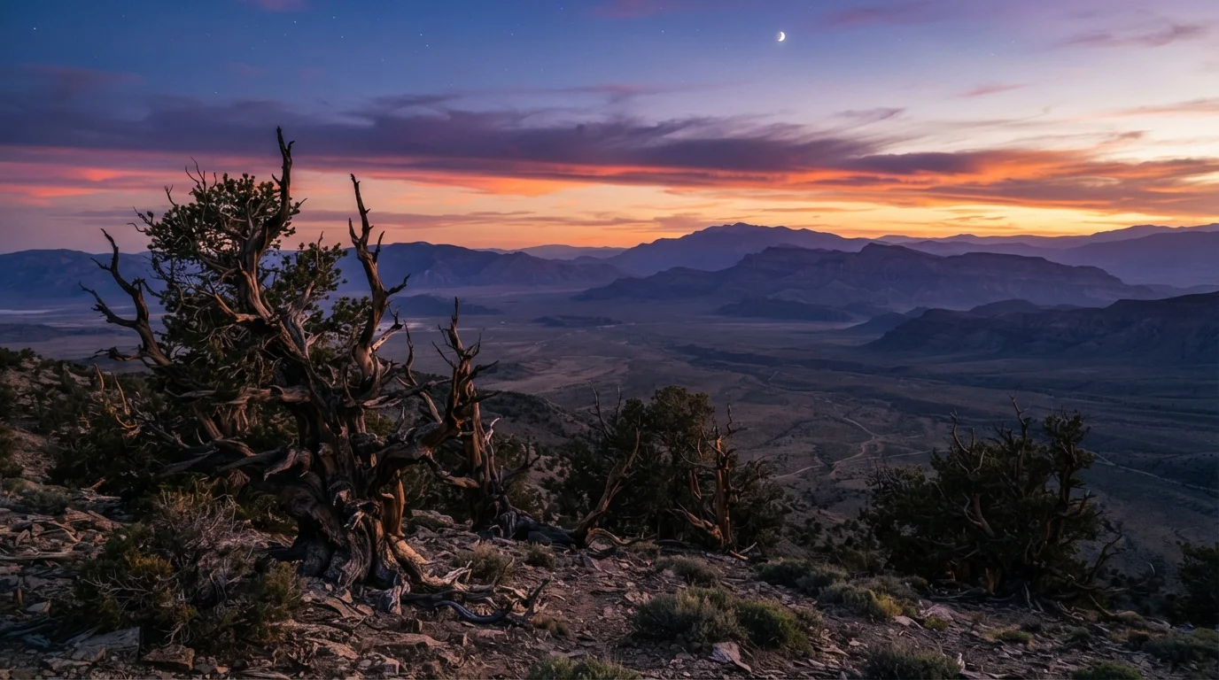
This defining characteristic - called endorheic drainage - shapes everything about the region: its salt flats, its alkaline soils, its shallow saline lakes, and its remarkable biological resilience. The Great Basin is not a basin in the conventional sense of a bowl. It is more accurately a corrugated landscape of parallel mountain ranges and valley floors, roughly 400 distinct ranges in total, each acting as a biological island separated by desert sea.
| Total area | Approximately 200,000 square miles (USGS Geographic Definitions) |
| States included | Nevada, Utah, Oregon, California, Idaho, Wyoming, Arizona |
| Drainage type | Endorheic (no outflow to ocean) (USGS Basin and Range Province) |
| Desert classification | Cold desert (Great Basin Desert) (North American Desert classification) |
| Notable natural feature | Bonneville Salt Flats - remnant of ancient Lake Bonneville |
| Oldest living organisms | Bristlecone pines, some exceeding 5,000 years (Great Basin National Park, NPS) |
| Distinct mountain ranges | Approximately 400 (Basin and Range geological surveys) |
| Dominant vegetation | Sagebrush steppe |
What Travelers Encounter on the Ground
Travelers who move between the Pacific Coast and the Mountain West - or who simply drive I-80 or I-15 - cross the Great Basin without realizing it. The experience from the highway is deceptive: brown flats, sparse scrub, and heat shimmer. Slow down, however, and the region reveals startling depth.
Great Basin National Park in eastern Nevada contains the only permanent glacier in the state, 5,000-year-old bristlecone pines among the oldest living organisms on Earth, and marble caves sculpted over millennia. The Bonneville Salt Flats in northwestern Utah - remnant floor of ancient Lake Bonneville - stretch so flat and white they appear lunar. Pyramid Lake in Nevada, a terminal lake on the Paiute Tribe's reservation, supports one of the few remaining populations of the Lahontan cutthroat trout and offers some of the starkest landscape photography on the continent.
For those already drawn to quiet roads, the comparison is instructive: while Highway 1's overlooked stretches reward drivers with rugged coastline, Nevada's Highway 50 - once dubbed by a national magazine "The Loneliest Road in America" - rewards patience with a different kind of beauty: austere, mineral, and genuinely uncrowded.
200,000+
Square miles of endorheic terrain
The Great Basin is the largest internally draining watershed in North America, according to USGS definitions.
5,000
Years old - oldest bristlecone pines
Ancient bristlecone pines in the Snake Range of eastern Nevada are among the oldest confirmed living organisms on Earth.
800+
Plant species in the Great Basin Desert
Many species are endemic to the region's isolated mountain ranges, which act as biological islands in a sea of desert.
Ecological and Cultural Dimensions
The Great Basin is North America's largest cold desert. Unlike the Sonoran or Mojave, it receives most of its precipitation as winter snow rather than summer monsoon, and it is dominated by sagebrush steppe rather than cactus. This ecology supports pronghorn, pygmy rabbits, greater sage-grouse, and more than 800 plant species - many found nowhere else on Earth.
The region is also deeply tied to Indigenous history. The Western Shoshone, Northern Paiute, and Southern Paiute peoples have inhabited this landscape for thousands of years, developing sophisticated knowledge of its seasonal rhythms, water sources, and food systems. Travelers should approach these connections with respect, seek out tribally operated visitor programs where available, and understand that significant portions of the Great Basin remain sovereign Native land.
Endorheic basin
A closed drainage system in which water has no outflow to an external body such as an ocean. Precipitation accumulates in interior lakes, sinks into the ground, or evaporates.
Basin and Range Province
A geologic region of alternating mountain ranges and valley floors created by the stretching and faulting of the Earth's crust. The Great Basin sits largely within this province.
Sagebrush steppe
An arid to semi-arid ecosystem dominated by big sagebrush and bunchgrasses. It is the defining vegetation type of the Great Basin and supports a unique web of dependent wildlife.
Terminal lake
A lake in an endorheic basin with no outlet. Water entering the lake can only leave through evaporation, which concentrates salts and minerals over time.
Accessibility and safety warrant honest acknowledgment. Distances between services can exceed 100 miles. Summer temperatures regularly exceed 100°F in valley floors, while high-elevation terrain can see freezing conditions year-round. Travelers should carry extra water, a physical map, and a charged communication device - cell service is intermittent across wide swaths of the interior. Entry requirements for specific natural areas vary; always confirm current conditions and permits with the relevant land management agency before departure.