A Landscape Unlike Anywhere Else in the American West
Most travelers who picture Washington State conjure the Space Needle, the rain-soaked streets of Seattle, or the volcanic silhouette of Mount Rainier. Almost none think of the Palouse - and that is precisely what makes it worth seeking out.
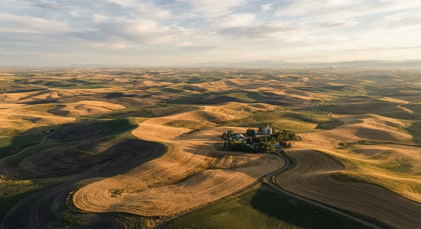
Stretching across the southeastern corner of the state and dipping into northern Idaho, the Palouse is a region of undulating hills so symmetrical and smooth they look almost sculpted. The hills roll into one another like frozen ocean swells, each one terraced with wheat or lentil crops that shift color with the seasons - vivid emerald green in late spring, rippling gold by midsummer, amber stubble through the fall. From the summit of Steptoe Butte, a quartzite outcrop that rises above the surrounding terrain like a ship's prow, the view in every direction is essentially uninterrupted farmland to the horizon. There are no billboards. No resort clusters. Just geometry and light.
~1.5M acres
Approximate area of Palouse farmland
The Palouse region encompasses roughly 1.5 million acres of primarily dryland wheat and legume farmland across Washington and Idaho.
3,612 ft
Elevation of Steptoe Butte summit
Steptoe Butte rises to 3,612 feet, high enough above the surrounding hills to offer a 360-degree panoramic view across multiple counties.
200+ ft
Typical depth of Palouse loess soil
Loess deposits in parts of the Palouse can exceed 200 feet in depth, producing some of the most fertile dry-land agricultural soil in North America.
The landscape owes its unusual character to loess - fine, wind-blown silt deposited over thousands of years - which built up into some of the deepest, most fertile topsoil on the continent. That same soil is what drew dry-land wheat farmers here in the late 19th century, and their descendants still work many of the same fields today.
What to Actually Do in the Palouse
The Palouse rewards slow travel. This is not a destination of curated attractions or ticketed experiences; it is a place to drive, stop, and look. State Route 272 between Colfax and Palouse town threads through the hills with the kind of unhurried grace that makes aimless driving feel purposeful.
Steptoe Butte State Park is the obvious anchor. A paved road climbs the butte - no hiking required - and the summit panorama has made it a legitimate pilgrimage for landscape photographers, particularly at sunrise and sunset when the hills cast long, dramatic shadows across the fields. The nearby community of Palouse itself, population under 1,000, has a tidy historic downtown and a grain elevator that has become an unlikely icon of regional photography.
Timing Your Visit for Peak Color
The window between late May and early July delivers the Palouse at its most visually dramatic - winter wheat is a deep, rolling green that gradually brightens before harvest turns it gold. If you arrive in August, the fields will be harvested stubble, which has its own stark beauty but lacks the vivid contrast of earlier months. Arriving mid-week also keeps you well clear of weekend day-trippers from Spokane.
Pullman, home to Washington State University, and Moscow, Idaho, home to the University of Idaho, give the region cultural ballast unusual for such a rural landscape. Both towns host farmers markets, independent restaurants, and live music venues - genuinely local scenes, not tourist infrastructure. The eight-mile stretch between them, known informally as the Palouse Corridor, is worth an evening stroll or a morning coffee crawl.
For those interested in pushing further, the Snake River Canyon carves the region's southern edge. The drive from Pullman down to Clarkston and Lewiston descends through dramatically different terrain - steep basalt cliffs dropping to the river - and opens the door to jet boat excursions into Hells Canyon.
Practical Notes for Getting There and Getting Around
The Palouse is genuinely rural, and that means planning accordingly. The nearest major airport is Spokane International, roughly 80 miles north of Pullman via US-195 - a straight, well-maintained highway that itself offers glimpses of the rolling terrain as you head south. Pullman-Moscow Regional Airport handles limited commuter service and is worth checking for travelers flying from Seattle's Sea-Tac.
A personal vehicle is effectively essential once you arrive. Public transit within the region is limited, and the most rewarding parts of the Palouse - the back roads, the grain elevators, the unmarked pullouts with sweeping views - require the freedom to stop and turn at will. Road conditions on county roads can be unpredictable in winter, and some scenic routes are best navigated in dry-weather months.
Entry and Travel Conditions to Verify
Some county and farm roads in the Palouse are unpaved and can become impassable after rain or snow. Always check Washington State Department of Transportation road condition updates before venturing onto back roads, particularly in early spring or late fall. Travelers should verify current conditions through official state and local sources before departure.
Accommodations in Pullman and Moscow range from university-adjacent hotels to small inns; the surrounding countryside has a growing number of vacation rental properties on or near working farms. Visitors who time their trip to coincide with WSU or U of I home football weekends should expect the area's lodging to fill quickly - booking ahead is advisable for those dates.
The Palouse asks nothing from you except attention. In a travel landscape increasingly defined by the same shortlist of overexposed destinations, that quiet invitation feels genuinely rare.